


Austrian Map mobile
คำอธิบายของAustrian Map mobile
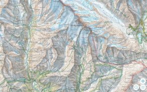
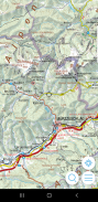
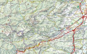
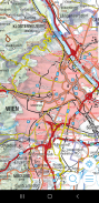
Austrian Map mobile (AMap mobile) ประกอบด้วยแผนที่ดิจิทัลของออสเตรีย รวมถึงการแรเงาเนินเขา ชื่อพื้นที่วัตถุจาก Digital Landscape Model (DLM) และ Digital Elevation Model (DGM) ผลิตภัณฑ์ของสำนักงานมาตรวิทยาและการสำรวจแห่งสหพันธรัฐ (BEV) นี้ไม่เพียงแต่นำเสนอแผนที่ภูมิประเทศคุณภาพสูงเท่านั้น แต่ยังมีส่วนต่อประสานที่ใช้งานง่ายพร้อมฟังก์ชันการทำงานที่หลากหลาย
แผนที่และข้อมูลที่มีอยู่:
- แผนที่ภาพรวม 1:1 ล้าน
- โมเดลการทำแผนที่ 1:500 000
- โมเดลการทำแผนที่ 1:250 000
- โมเดลการทำแผนที่ 1:50 000
ข้อมูลแผนที่ทั้งหมดของ AMap mobile มีให้บริการฟรีและจัดเก็บไว้ในสมาร์ทโฟนหรือแท็บเล็ตที่เกี่ยวข้อง (ใช้งานออฟไลน์ได้)
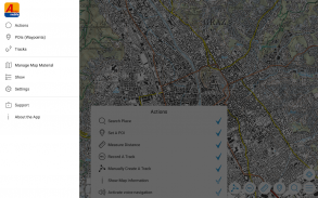
ฟังก์ชั่นของมือถือแผนที่ออสเตรีย:
- ค้นหาตามชื่อสถานที่หรือค้นหาตามพิกัด
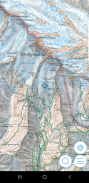
- ฟังก์ชัน GPS: แสดงตำแหน่ง "แผนที่เคลื่อนที่" รองรับเข็มทิศ กำหนดเส้นทางตามเส้นทาง
- แทรก แก้ไข และแบ่งปัน POI (จุดสนใจ)
- การบันทึกและส่งแทร็ก
- ข้อมูลเกี่ยวกับแผ่นแผนที่ที่แสดง
- การวัดระยะทางและพื้นที่
Austrian Map mobile - ข้อมูล APK
เวอร์ชั่น APK: 2.1.4แพ็คเกจ: com.garzotto.ammaเวอร์ชั่นล่าสุดของAustrian Map mobile
เวอร์ชั่นอื่น


แอปในประเภทเดียวกัน


